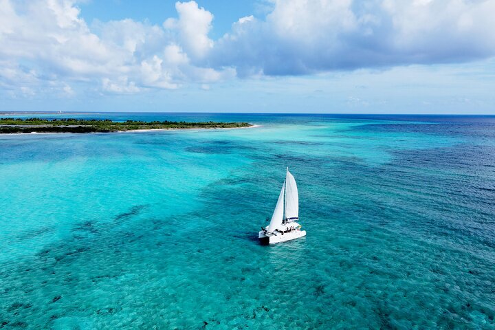
Lagoon 39ft Private Catamaran 5hr - El Cielo Full Experience
5 hours
From AUD 3091.47
The Copper Canyon system is genuinely humbling. Four canyons deeper than the Grand Canyon, pine-oak forest giving way to subtropical barrancas, and a culture — the Tarahumara, or Rarámuri — that will quietly rearrange your priorities.
Over roughly five to seven days, you cover around 300 kilometres of terrain that swings between smooth tarmac on the canyon rim and loose, rock-studded dirt tracks that descend hundreds of metres in tight switchbacks. Expect cumulative elevation gain well above 5,000 metres. This is not a route that flatters tired legs.
Most riders base themselves at Creel and use it as a hub for initial acclimatisation around 2,400 metres before committing to deeper canyon descents toward Batopilas or Urique. The climb back out from Batopilas — roughly 1,600 metres of steep, corrugated dirt — is the moment you either love this route completely or question all of your choices.
Surface quality varies wildly: good asphalt on the upper plateau, punishing cobblestones through canyon villages, and stretches of red dirt that turn treacherous after rain. Bring puncture-resistant tyres and carry more water than you think you need, as reliable resupply points are sparse below the rim.
The Chepe Express train running along the canyon edge offers a legitimate bail-out or shuttle option, which matters on a route this demanding. Bike hire exists in Creel but is limited and basic — serious riders should bring their own machine. Small guesthouses and mission-run lodges provide accommodation at key stops, though booking ahead in high season is wise.
October and November offer the most stable weather, lower humidity, and clear canyon views; avoid July and August when summer rains make dirt descents genuinely dangerous.
When Priya from our BugBitten team rolled out of Creel at first light, the air was sharp and cold — the kind of cold that bites through a base layer and reminds you that 2,400 metres above sea level is not a suggestion. The pine trees along the plateau road were still dark shapes against a grey sky. Her front tyre crunched over frost-stiffened gravel. Somewhere below, invisible beneath cloud that hadn't yet burned off, four canyons waited — each one deeper than the Grand Canyon, each one entirely indifferent to how ready she felt.
She'd been planning this ride for fourteen months. She had the right bike, the right tyres, a handlebar bag stuffed with electrolytes and a first-aid kit, and a route downloaded onto a Garmin that she'd already learned not to trust completely. What she hadn't fully prepared for was the moment the road tipped downward past the canyon rim and she could suddenly see everything — the red and copper walls, the green thread of a river far below, the sheer geological ambition of the place — and her hands tightened on the brakes not because the descent was dangerous yet, but because the sight of it made her want to stop and just look.
That feeling — the physical effort colliding with something more difficult to name — is what this route does to people. It is demanding in ways that go beyond fitness. It asks you to pay attention in every sense of the word.
There are longer cycling routes in the world, and there are harder ones. The Copper Canyon loop sits at roughly 300 kilometres over five to seven days, with cumulative elevation gain that exceeds 5,000 metres. On paper, that's a challenging but manageable week of riding for a fit cyclist. On the ground, the numbers feel different.
Part of what sets this apart is the sheer range of terrain packed into those 300 kilometres. You begin on the Sierra Tarahumara plateau — smooth-ish tarmac, pine forest, clean air — and within a day or two you're winding down switchbacks on corrugated dirt tracks into a subtropical canyon world where the temperature has climbed 15 degrees and the vegetation has gone tropical. The same ride takes you through pine-oak forest, past agave-studded slopes, across streambeds, and into villages where the main road is cobblestone and the local shop might or might not have anything you need.
The cultural dimension is equally significant. The Rarámuri people, also known as the Tarahumara, have lived in and around these canyons for centuries. They are famously long-distance runners — their traditional running culture is documented and genuinely extraordinary — but they are not a tourist attraction. You will see them along the road, selling crafts or simply going about their lives. The appropriate response is basic courtesy: acknowledge them as you would anyone, buy something if you want, and don't point cameras without a clear signal that it's welcome. Priya described the experience of passing through Rarámuri communities as quietly humbling in a way she hadn't expected — not dramatic, not performative, just a reminder that the canyon is someone's home, not a backdrop.
The route's signature section, and the one most riders talk about long afterwards, is the descent to Batopilas and the climb back out. The descent is roughly 1,600 metres of altitude lost over dirt roads that are thrilling on good days and genuinely treacherous after rain. The climb back up is all of that in reverse, with tired legs and the sun usually at the wrong angle. It is the section where the route stops flattering anyone.
The state of Chihuahua is Mexico's largest by area, and the Copper Canyon region occupies its western edge where the Sierra Madre Occidental drops away in a series of massive escarpments. It doesn't feel like the Mexico that most travellers picture. There's no beach, no colonial plaza buzzing with tourists, no tequila-soaked resort strip. If you've spent time in Cancún or other coastal destinations, arriving in Creel can feel like stepping into a different country entirely — which, in a cultural and geographic sense, it nearly is.
Creel itself is a small, functional town that exists largely to service the timber industry, the Chepe train, and a steady stream of adventurous travellers. It has a central plaza, a few good restaurants, some decent guesthouses, and a hardware store that will sell you zip ties and inner tubes if you ask nicely. It is not charming in a postcard sense. It is practical and slightly rough around the edges and genuinely useful, which matters more.
The landscape on the rim feels high and austere. The canyon landscape below feels ancient and almost impossibly alive. Between those two worlds, on the switchback roads that connect them, you cycle through a transition zone that doesn't really belong to either. That in-between state — physically and atmospherically — is part of what makes the riding here feel unlike anything else.
Most riders structure the loop around Creel as a hub, spending the first day or two acclimatising and doing shorter rides on the plateau before committing to the big canyon descents. The main destinations below the rim are Batopilas — a former silver-mining town at the bottom of a dramatic canyon — and Urique, which sits in the deepest of the four major canyons. Both are genuinely worth reaching. Both involve significant descending and the same distance back up.
The Chepe Express train runs along the canyon edge and deserves a specific mention because it changes the calculus of the whole route. It is a legitimate bail-out option, not a shameful one. If your knee gives out on day three or a storm rolls in and turns the Batopilas descent into a mud slide, the train exists and it goes where you need to go. Knowing that is there makes the whole thing slightly less consequential, which is not a bad thing on a route this committing.
If your legs need a day off — and they will — Creel has a handful of worthwhile stops. The valley of mushroom rocks (Valle de los Hongos) is a short ride or walk from town. The San Ignacio mission, like many of the old Jesuit foundations in this region, carries real historical weight. Mexico's cultural heritage runs deep in the Sierra Madre, and while the Palacio de Bellas Artes in Mexico City is a world away, the same thread of indigenous and colonial history that shaped that institution reaches all the way to these canyon communities. It's worth taking a rest day and actually looking around.
October and November are the consensus choice, and the consensus is right. The summer rains have finished, the humidity has dropped, canyon views are clear, and the dirt roads on the descent to Batopilas have had enough time to dry out and firm up. Temperatures on the rim are cool to mild during the day and cold at night. Temperatures in the canyon bottom are warm but not brutal. It is the sweet spot.
March and April are the secondary option — dry season, warm but not hot, and quieter than autumn. The landscape is drier and dustier, and some of the canyon vegetation looks parched, but the riding conditions are solid.
July and August: avoid them. The summer rainy season turns the dirt descents into something between a river and a mud chute. Flash flooding is a real risk in the lower canyons. The humidity in the barrancas becomes genuinely oppressive. This is not exaggeration — Priya spoke to a cyclist who'd attempted the Batopilas descent in August and described it as four hours of controlled sliding and profound regret.
December and January bring cold to the rim — occasionally below freezing overnight — and occasional snow. Not impossible, but significantly harder, and some guesthouses reduce hours or close.
The standard entry point is flying into Chihuahua City, which has regular connections from Mexico City, Monterrey, and a handful of US border cities. From Chihuahua, the Chepe Express train runs to Creel — a classic journey in its own right, winding up through the foothills and into the Sierra Madre. The train is the recommended approach if you're travelling with a bike box, as bus options are more complicated for oversized luggage.
If you're exploring further across Mexico before or after, the Visit Mexico official site has up-to-date transport information and regional guides that can help with connecting itineraries. The site is genuinely useful for planning the broader trip.
For more places in Chihuahua worth visiting before or after the ride, the state capital has a good cathedral, an excellent regional museum, and several good restaurants where you can eat an enormous meal and feel entirely justified about it.
Accommodation along the route runs from small family-run guesthouses in Creel to mission-operated lodges at key canyon stops. Book ahead for October and November — high season fills quickly and options are limited.
Let's be direct about a few things.
Bike hire is disappointing. What's available in Creel is basic — heavy mountain bikes in varying states of maintenance. If you're serious about this route, bring your own machine. The logistics of flying with a bike box are annoying but entirely worth it. A poorly maintained rental on the Batopilas descent is not a situation you want to be in.
Resupply is genuinely sparse below the rim. The gap between reliable food and water stops can be long, and there's no guarantee that the shop shown on your map is still operating. Carry more water than you think you need. Carry more snacks than feels reasonable. Run the numbers before each descent.
Safety context matters. Parts of Chihuahua state have experienced significant security issues over the past decade, and it would be dishonest to pretend otherwise. The Copper Canyon tourist corridor is generally considered safe for travellers, and the route doesn't pass through the areas of highest concern — but you should check current advisories from your home country before going. The Australian government's Smartraveller site and equivalent resources in other countries provide real-time guidance.
It is physically hard. 5,000 metres of cumulative elevation gain over 300 kilometres, on varied surfaces, at altitude, in heat. The Copper Canyon system is listed among the significant natural landscapes of the Americas, and the UNESCO World Heritage List gives you a sense of the scale of recognition these landscapes carry globally — which is gratifying, but doesn't make the Batopilas climb shorter. Be honest with yourself about your fitness level before committing.
Priya came back from Copper Canyon two kilos lighter, with a rear derailleur that needed replacing and a set of photographs she said don't really capture what it looked like. She also said, unprompted, that it was the best week of riding she'd ever done.
That's a recommendation, with caveats. This is a route that demands real preparation — the right bike, the right fitness, the right timing, and a genuine willingness to be uncomfortable for significant stretches of the day. It will not smooth over the hard bits. The descent into Batopilas will be as steep as it is. The climb back out will be as long as it is. The altitude on the rim will be as thin as it is.
What it gives back — the canyon walls in the afternoon light, the temperature shift between worlds, the villages that have existed in these canyons longer than the road down to them, the particular satisfaction of a climb completed — is real and significant. It is the kind of riding that you carry with you.
At BugBitten, we don't recommend things lightly. This one we recommend.

