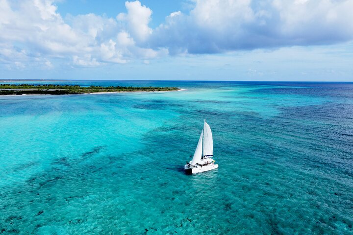
Lagoon 39ft Private Catamaran 5hr - El Cielo Full Experience
5 hours
From AUD 3091.47
The Yucatán Peninsula is pancake flat, which sounds boring until you realise that flatness is precisely what lets the jungle close in around you. Riding between Valladolid, Chichén Itzá, and the coast, you're threading narrow back roads where ceiba trees arch overhead and the air smells of damp earth and something older and wilder than anything I've encountered in Europe.
The "various kilometres" listed on most tour itineraries typically works out to 40–80 km per day over three to six days, depending on whether you're dawdling into cenotes or pushing toward a beach finish near Tulum or Progreso.
The surface is genuinely mixed: smooth federal highway shoulders share the itinerary with patchy asphalt side roads and occasional compacted limestone tracks that punish thin tyres. Bring 35c or wider, and keep tyre pressure on the lower side. Traffic on minor jungle roads is light, but the main highways carry fast-moving trucks, so staying on recommended back routes matters.
Elevation gain is negligible — the peninsula barely rises above 50 metres anywhere — but heat and humidity are their own gradient. Start riding by 7 am and you'll finish well before the midday oven.
Bike hire is easy in Valladolid and Mérida, with several operators offering hybrid and touring bikes by the day or week. Accommodation ranges from hammock guesthouses in village ejidos to mid-range hotels in colonial towns. Carry at least two litres on you at all times; roadside water stops are sparse between ruins sites.
The cenotes reward every sweaty kilometre: dropping into cold, clear water beside ancient limestone walls is the kind of payoff that makes the humidity feel earned.
Ride November to February for manageable temperatures and low humidity; anyone susceptible to heat exhaustion should avoid June through September entirely.
When Priya from our BugBitten team rolled out of Valladolid at quarter past six on a Tuesday in late November, the light was still that low, amber kind that makes everything look like a film still. The streets were quiet except for a couple of tianguis vendors setting up tacos de canasta, and the air carried that particular smell of damp stone and wood smoke that colonial Mexican towns do so well. She had a rented hybrid loaded with two full bidons, a poncho stuffed into the panniers, and directions to a back road that would take her west through the jungle toward the ruins of Chichén Itzá — roughly 45 kilometres of riding that, if she timed it right, she'd finish before the heat turned serious.
What she didn't expect was how quickly the town dropped away. Within four kilometres, the road narrowed to a single lane edged with dense scrub, and the ceiba trees started doing their thing — enormous trunks heaving up from the limestone, their canopy spreading wide enough to block whole patches of sky. A pair of motorbikes passed in the opposite direction, horn tapped in greeting, and then she was alone. Not the anxious kind of alone, but the good kind, where you settle into your own rhythm and stop thinking about anything except the road in front of you.
That first hour set the tone for everything that followed. Flat, yes — the Yucatán Peninsula barely rises above 50 metres anywhere across its breadth — but flat in a way that forces all the interest sideways. There's jungle to your left, ruins behind a fence to your right, a cenote sign pointing down a dirt track every 15 kilometres or so, and a sun that is working very hard to remind you it is also a star.
This is what Maya Jungle Trail Cycling actually is: not a single marked route, not a tour company product, but a way of moving through one of the most archaeologically and ecologically loaded landscapes in the Americas. It rewards planning, a reasonable level of physical confidence, and a genuine willingness to start pedalling before breakfast.
The simplest answer is density. Few places on earth pack this many categories of remarkable thing into this much flat, bikeable terrain. You have living jungle, colonial cities, one of the world's most visited archaeological sites, a coast, and a subterranean water system — cenotes — that functions as both geological spectacle and practical swimming hole. A car moves through all of this too fast. A bus selects for you. A bicycle lets you catch the side roads, the village basketball courts, the small shrines where someone has left fresh flowers at the base of a ceiba.
The core riding loop that most independent travellers assemble connects Valladolid in the east, Chichén Itzá in the middle, and either Mérida to the northwest or the Caribbean coast near Tulum to the southeast. That gives you anywhere from 150 to 280 kilometres of total riding, depending on detours, typically spread across three to six days. Most days work out to between 40 and 80 kilometres of actual pedalling. For anyone who cycles regularly, that's a comfortable half-day effort. For someone who hasn't been on a bike in a while, it's absolutely achievable — just start early and respect the heat.
The cenotes alone justify the logistics. Cenote Suytun near Valladolid, for instance, is a genuinely extraordinary place — a cathedral-like cavern with a shaft of light hitting circular blue water — and arriving there under your own steam, sweaty and tired, makes the drop into cold water feel genuinely earned rather than like a tick on a tour bus checklist. Our Cenote Suytun guide covers the best of the Yucatán's cenotes in detail if you want to plan detours around the best swimming holes on your route.
The archaeological layer is equally hard to overstate. This is a landscape where the Maya didn't just leave ruins — they shaped the entire hydrology and road system of the peninsula. The ancient sacbé (white roads) run beneath some of the paths you'll be riding. That context makes every kilometre feel like it carries more weight than the physical distance suggests.
People who haven't been to the Yucatán sometimes picture it as a beach destination with some ruins nearby. That misses the point entirely. The interior of the peninsula is dense, green, and ancient in a way that's more central American jungle than Mexican resort. The flora runs from low thorny scrub near the coasts to tall, cathedral-ceiling jungle canopy further inland, and on back roads you'll often be riding through a green tunnel that blocks direct sunlight and holds humidity like a greenhouse.
That humidity is real and constant. Even in the dry winter months, the air carries moisture, and by nine in the morning on a clear day you will be sweating regardless of effort level. The jungle manages it better than open road — the shade is a genuine, practical gift — but there's no avoiding the fact that this is a tropical environment and your body will work harder here than it would on a similarly flat route in, say, the south of France.
Soundscape matters here too. The birds are loud, varied, and sometimes invisible in the canopy above — toucans, parrots, and keel-billed motmots all common along jungle sections. At dawn, before the truck traffic picks up on the federal highways, the back roads carry an almost complete absence of mechanical noise, and the combination of birdsong, wind through ceiba leaves, and your own tyres on patchy limestone is about as good as riding gets.
Villages along the route are small, often Maya-speaking communities where a bicycle is still a practical daily tool rather than a recreational object. That creates a kind of relaxed welcome — locals wave, kids occasionally try to race you for 50 metres, and the fondas (small local restaurants) serve the best food on the route by a considerable margin.
This sounds obvious but bears emphasis: the federal highway between Valladolid and Chichén Itzá carries fast, heavy truck traffic and is deeply unpleasant to ride on. The parallel back roads — most of them accessible via free apps like Komoot or through routes shared by bike tour operators in Valladolid — add distance but subtract stress. The patchy asphalt and compacted limestone surface on these roads requires tyres of at least 35mm width, ideally wider if you're touring with luggage. Keep pressure on the lower side of the tyre's recommended range; the occasional limestone track is hard on tight tyres.
The cenotes that sit close to the main archaeological sites fill up with tour groups between 10am and 2pm. If you're arriving by bicycle, you have the advantage of flexibility — you can be in the water by 8am and back on the road before the first coach rolls in. Privately owned cenotes charge entry fees (typically 50–150 Mexican pesos), and some of the best ones sit well off the main road, signposted with hand-painted boards you'd blow straight past at car speed.
Everyone knows the site; fewer people manage to visit it before the crowds arrive. Entrance opens at 8am and the massive stepped pyramid known as El Castillo is best seen in the flat early-morning light before tour buses deposit their first load of visitors. As a cyclist you can lock up near the east entrance and walk straight in without the car-park queue. The site is a UNESCO World Heritage Site and has been receiving visitors in extraordinary numbers in recent years; early arrival isn't just pleasant, it's practically necessary for a meaningful experience.
The food stalls and restaurants at the major ruins sites are overpriced and mediocre. The village fondas en route — particularly in Pisté, Libre Unión, and Dzitnup — serve cochinita pibil, sopa de lima, and fresh tortillas at prices that make the ruins entrance fees feel expensive by comparison. Ask locals where they eat.
November through February is the comfortable window, full stop. Temperatures run 24–28°C during the day, humidity is lower than the summer months, and rainfall is infrequent. December and January are peak tourist season overall but the back roads and jungle sections remain quiet compared to the major sites.
March and April are borderline — manageable in the early morning, increasingly brutal by mid-afternoon. If you're riding in this window, plan shorter days and build in a long midday break.
May through October is the rainy season, and June through September in particular brings a combination of heat, humidity, and unpredictable afternoon downpours that turns even an easy 40-kilometre day into an endurance event. Anyone with a history of heat exhaustion should treat this period as a hard no. The roads also flood on low sections, and the jungle insects — mosquitoes especially — are dramatically more active.
The Visit Mexico official site has current regional weather information and seasonal travel advisories worth checking before you book flights.
Getting to the start point: Most riders begin in Valladolid, which is well connected by ADO bus from Cancún airport (about 2.5 hours, very comfortable), from Mérida (2 hours), or from Tulum (1.5 hours). Bikes travel in the luggage hold on ADO services — box or bag them, and book ahead. Alternatively, begin in Mérida if you prefer a gentler urban start before heading into the jungle section.
Bike hire: Valladolid has several hire outfits clustered near the central park. Quality varies; inspect any bike before you pay, check that the gears shift cleanly and the brakes work hard. Hybrid and light touring bikes are the most common offerings. If you want a specific tyre width, ask explicitly — many shops default to road bikes that are wrong for this terrain. Mérida has a broader selection if you have a day to sort equipment before heading east.
Nearby stops worth including:
For more suggestions across the region, the BugBitten team has compiled more places in Yucatán worth adding to your route.
Honest talk: this route is not packaged or signed. You will make navigation errors, particularly on the limestone back roads where two tracks look identical and offline maps disagree with the ground truth. Budget extra time for this, and download multiple map sources before you leave wifi range.
The surface condition changes unpredictably. A section that was smooth asphalt in November can be washed out and rutted by the following February after one heavy storm. There's no central authority maintaining these roads to cycling standard, and you'll occasionally have to push through a section that would shred a tube on thin tyres.
Roadside shade is inconsistent. The jungle sections are genuinely shaded; the open agricultural stretches between ruins sites are not, and on a clear day the sun between 9am and noon is punishing. The lack of roadside water stops between the main towns is a real problem — there are stretches of 20 to 30 kilometres where nothing is available. Two litres is a minimum carry; three is safer on full-sun days.
Safety on the federal highway shoulders is a genuine concern. The trucks travel fast and the shoulders are sometimes narrow or blocked by parked vehicles. There's no avoiding short sections of federal highway entirely, and these require full concentration and confident road presence. If you're not comfortable riding near heavy vehicles, reconsider the route timing or use a guide service for those sections.
Accommodation in small villages ranges from basic to very basic. The hammock guesthouses in ejido communities are charming but not always clean, and hot water is occasionally a theoretical rather than practical feature. If that matters to you, plan your overnight stops around the larger towns.
The Maya Jungle Trail doesn't have a marketing department. There's no single branded experience to book, no finish-line medal, no curated Instagram route. What exists is a genuinely extraordinary piece of terrain — ecologically dense, archaeologically profound, logistically achievable — that rewards careful planning and early mornings.
Priya finished her Valladolid-to-Chichén Itzá day by 10:30am, dropped into a cenote just east of the ruins, and ate lunch in Pisté for about 80 pesos. She said afterwards it was one of the better cycling days she'd had anywhere, not because of any single spectacular moment, but because of the accumulation — the birds, the limestone, the cold water, the taco, the total absence of anyone telling her where to look. That's the pitch, honestly. It's not dramatic. It's just very, very good riding through a landscape that has earned its weight in human history, and it's available to anyone willing to get on a bike before the sun gets serious.
Pack your widest tyres, charge your GPS, set your alarm for half five, and go.


